
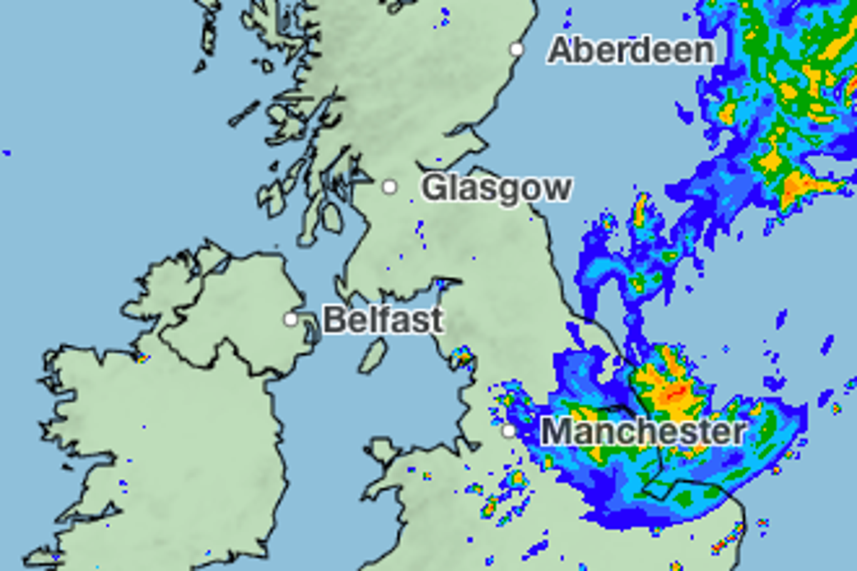
The United Kingdom is heading into a week of unsettled weather, with the Met Office mapping out a series of thunderstorms and prolonged rain showers that will sweep across large parts of the country as August ends. Forecasters warn that the pattern marks a sharp shift from the string of heatwaves that have dominated recent months. Read also: UK MP Rupert Lowe Earns £100K From X Posts, Beats Salary.
Rain is expected to arrive first in the southwest and south Wales on Tuesday, before a broader band of showers moves across southern England on Wednesday. By Thursday, heavy downpours are predicted over the West Midlands, progressing northward toward Manchester and Leeds, while the east of England could see intense rain Thursday night. The Met Office also flags a chance of thunderstorms over Manchester and Newcastle on Sunday afternoon.
Despite the wet outlook, temperatures are set to climb, with London potentially reaching 26 °C on Thursday and most regions sitting in the low‑to‑mid 20s for the rest of the week. Warm spells may still appear, but they are likely to be brief and near seasonal averages.
This turn comes after a record‑breaking summer: 2026 became the first year on record to log three separate days above 37 °C and four days at 36 °C or higher. Before this year, the UK had only recorded 37 °C or more on six occasions. July was the driest month since records began in 1836 for both England and Wales, and southern England experienced its driest calendar month ever. By mid‑July the country had already logged more days above 30 °C than the entirety of the notorious 1976 heatwave. The prolonged heat has left roughly 70 % of England and Wales in drought, meaning the incoming rain, while welcome, will need to be sustained to ease the deficit.
Looking ahead, the Met Office’s long‑range outlook for the Bank Holiday weekend points to continued showers, longer rain spells, strong winds, and further thunderstorm risk. The weather is expected to remain changeable through the first week of September, with above‑average rainfall for the period, interspersed with occasional drier, settled intervals and short‑lived warm spikes.
For the public, the shift means potential disruptions to outdoor events, travel delays, and heightened flash‑flood risk in urban areas where drainage systems are already stressed by months of dry ground. Farmers and water managers will be watching closely, as the combination of heavy bursts and lingering drought could create both relief and new challenges. The pattern also underscores a broader climate trend: extreme heat episodes are becoming more frequent, while the transition to wetter, stormier conditions can arrive abruptly, a dynamic that has been observed in recent European summers.