
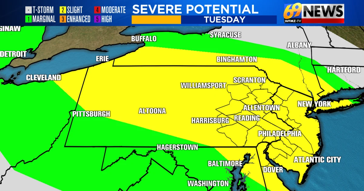
Warmth and high humidity are fueling the potential for gusty thunderstorms across eastern Pennsylvania and New Jersey from late afternoon through this evening.
Severe Thunderstorm Watch Through Midnight
A severe thunderstorm watch has been issued for the entire area through midnight tonight. The main threats are damaging wind gusts and large hail. An isolated tornado or two is also possible, although the risk remains much lower.
Any thunderstorm, whether severe or not, can produce frequent lightning and heavy downpours. Because of the high humidity, slow-moving storms could also cause localized flooding and quickly drop one to two inches of rain.
Storm Timing and Movement
Thunderstorms began developing around 4pm across parts of eastern PA and northern NJ. Storms are expected to become more widespread and intensify from late afternoon through this evening as they move generally from north to south, or more specifically from northwest to southeast, across the area.
The most likely time for severe storms is late afternoon through mid-evening, roughly from 5pm through 11pm as storms move from north to south across eastern PA and New Jersey.
Stay with WFMZ-TV 69News, the 69News Weather Channel, wfmz.com, and the 69News Storm Center App as severe weather approaches. The free mobile app provides the latest radar images, watches and warnings, and forecasts from the station’s storm team.
WFMZ meteorologists will track potential severe storms during the early evening newscasts from 4pm through 6:30pm on WFMZ-TV, as well as during the 8pm newscasts.
A severe thunderstorm watch does not guarantee that severe weather will occur. Instead, it indicates that conditions are favorable for potentially damaging storms. If storms develop and become imminent in your area, a severe thunderstorm warning will be issued.
TRACK THE WEATHER: HOUR BY HOUR | RADAR | TRAFFIC
Source: www.wfmz.com